
Big acreage can be exciting on paper, but in a mountain community like The Reserve, the real question is how that land actually works for your goals. If you are considering a 10-acre-plus tract for a private retreat, future estate home, family compound, or long-term hold, you need to look well beyond the acreage count. This guide walks you through the practical issues that shape value and usability at The Reserve in Transylvania County, so you can evaluate land with more clarity and confidence. Let’s dive in.
The Reserve in Pisgah Forest is best understood as a gated mountain-estate community rather than a typical subdivision. Current brokerage and MLS materials describe it as roughly 1,100 acres with 10-acre minimums and about 53 homesites, with recent listings ranging from about 10.54 acres to more than 40 acres. Those descriptions are market-facing rather than official county records, but they help explain why buyers are drawn to the community for privacy, views, and estate-scale ownership.
For you as a buyer, that means size is only the starting point. Two parcels with similar acreage can perform very differently depending on road access, ridge exposure, septic feasibility, topography, and how the homesite is positioned on the land.
When you evaluate land at The Reserve, the number of acres does not tell you how much of the property is truly usable. A 20-acre tract with a strong homesite, workable slopes, and established access may be more functional than a larger parcel with limited building areas or higher site-prep costs.
That is especially true in Transylvania County, where the entitlement picture can vary from tract to tract. According to the county’s planning and community development ordinances, there is no county-wide zoning outside the City of Brevard, the Town of Rosman, and Brevard’s ETJ, but several land-use ordinances still affect large tracts.
One of the first steps is understanding which local rules apply to the specific parcel. In Transylvania County, land may still be affected by subdivision control, mountain ridge protection, scenic corridor designation, flood damage prevention, watershed protection, and other ordinances, even where county-wide zoning does not apply.
If a property falls within the Pisgah Forest Community Zoning District or an ETJ, the county notes that you should confirm that on the GIS and not assume the land is governed only by the expectations of a large-lot mountain community. In other words, each tract needs to be evaluated on its own facts.
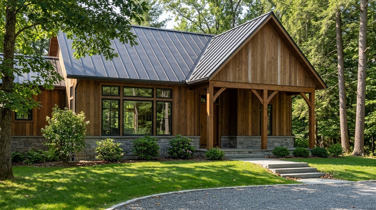
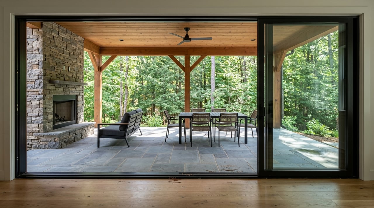
A large tract can offer privacy and flexibility, but much of the value often comes down to one key decision: where the home sits. In mountain settings, homesite placement affects views, sunlight, privacy, driveway design, tree clearing, and future building options.
Current listing descriptions in The Reserve highlight long-range views of areas like Pinnacle Mountain, the Little River Valley, and the French Broad and Little River valleys. That market context points to what many buyers already know intuitively: orientation matters. The best tract for you may be the one that protects a specific view axis, captures winter light, and still allows practical access.
Long-range views are a major part of the appeal in The Reserve, but not every view is equally durable. You will want to think about whether the homesite preserves the best outlook from the main living spaces, outdoor areas, and any future guest or accessory structures.
A good evaluation also considers how much clearing may be needed and whether that clearing could affect the visual character of the site. In mountain markets, a great homesite is often the anchor of long-term value.
The county’s Mountain Ridge Protection Ordinance applies to taller structures on protected ridges and requires a permit for structures over 40 feet, along with a visual impact assessment from certain key viewpoints. For estate properties, that can matter if you are considering a taller home design or future structures such as barns, towers, or guest buildings.
The scenic corridor ordinance also supports preservation of important public views along designated roads and highways. That does not mean land is unusable, but it does mean siting and design choices deserve careful attention.
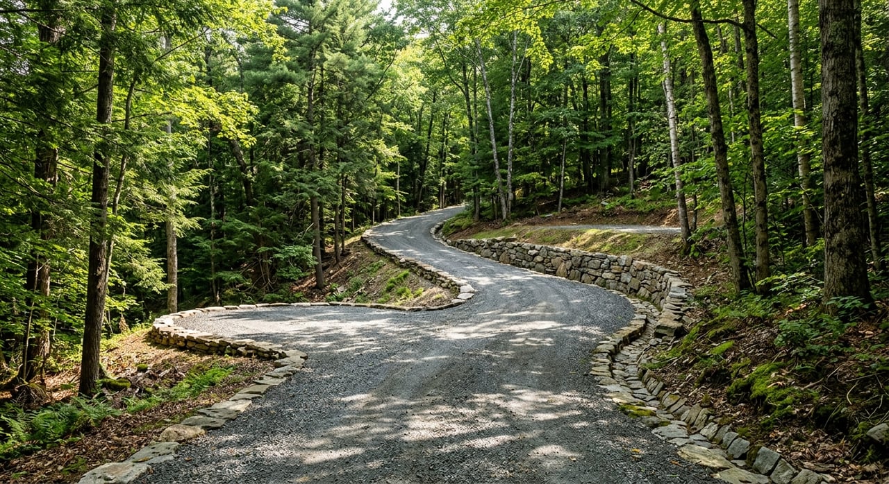
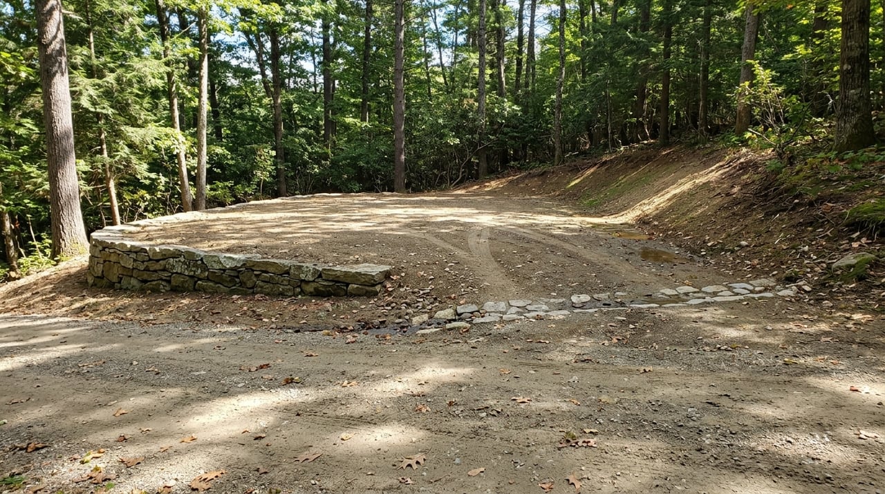
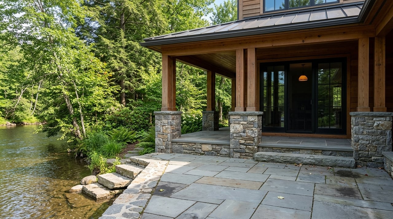
On mountain acreage, access can make or break a property’s usability. You may love the views from a ridge-top setting, but the road required to reach that homesite still has to be practical, durable, and appropriate for the terrain.
Transylvania County’s Subdivision Ordinance gives useful guidance here. It states that private subdivision roads still must meet minimum standards, including a 45-foot right-of-way, a 35-foot cul-de-sac radius, and an 18% maximum road grade in standard cases, with added documentation required above that threshold.
As you walk or review a parcel, pay attention to:
The ordinance also requires road design to accommodate 10-year storm runoff. That is one reason a cut driveway or installed access can be such a meaningful improvement on a mountain tract.
Before you fall in love with a parcel, check the basics that will determine whether and how you can build. In this area, utility feasibility often starts with septic, well placement, and whether any flood-related permitting could apply.
Transylvania County’s Building Permitting and Enforcement department notes that construction in designated flood areas requires a Floodplain Development Permit, while Environmental Health handles on-site wastewater and private water wells. For large acreage, these are not minor details. They shape the build envelope from the start.
Recent Reserve listings also show how improvements can change a tract’s readiness. Some have noted pending septic applications, others advertise a current four-bedroom septic permit and installed driveway, and some mention multiple potential homesites. That kind of variation can have a major effect on timing, budget, and flexibility.
In mountain settings, resilience is part of due diligence. Access roads, slopes, drainage, and utility systems all matter more when weather conditions change quickly.
Transylvania County emergency management and hazard mitigation materials identify flooding, high winds, landslides, and debris flows as serious local threats. The county also issued a declaration of local state of emergency in September 2024 before Hurricane Helene, which underscores why buyers should think beyond day-one beauty.
As you evaluate a tract, consider:
For larger compounds, the county subdivision ordinance also includes fire-access-related requirements in certain cases, such as dry hydrant systems where a fire-suppression-rated water system is not available. Even if you are buying a single homesite parcel, that requirement gives insight into how seriously the county views emergency access on wooded mountain land.
Not every large tract should be judged the same way. The right property for a private retreat may be different from the right property for a family compound, a conservation-minded hold, or a parcel with future division potential.
That is why it helps to define your ownership goal early. If you want maximum privacy and a view-focused estate site, the best parcel may be one with a single exceptional build area. If you want flexibility for future structures or multiple generations, the tract needs to work on a broader planning level.
At The Reserve, buyers often evaluate acreage for goals such as:
The right due diligence questions will change depending on which path best fits your plans.
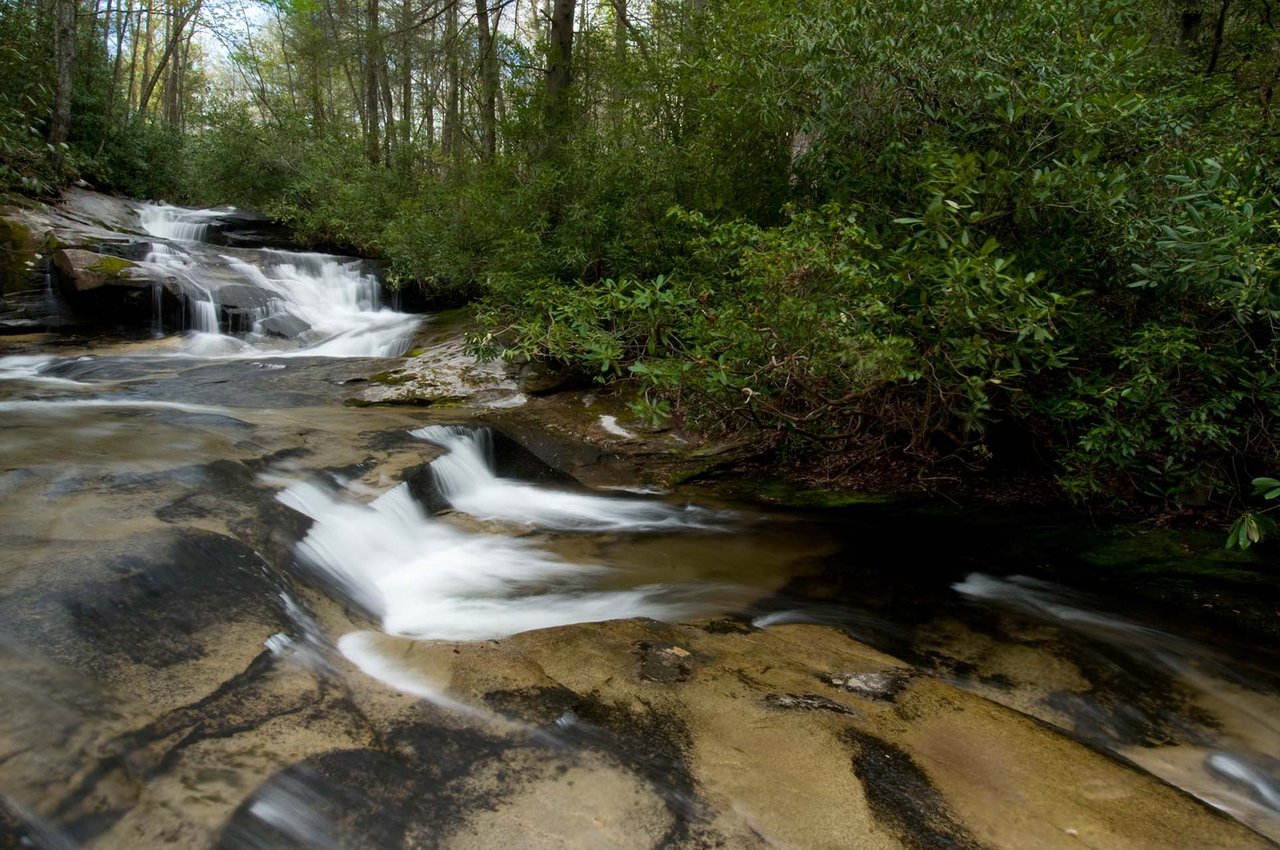
One reason acreage in this part of Transylvania County stands out is the outdoor setting. The area is near major public lands that help shape the overall lifestyle appeal, including Pisgah National Forest, which spans more than 500,000 acres and offers hiking, biking, fishing, horseback riding, and scenic drives.
That context supports a stewardship mindset. If you are buying a larger tract, a woodland plan may help organize long-term objectives such as habitat, recreation, natural beauty, and future transfer planning. The North Carolina Forest Service explains that a woodland plan can support technical guidance, possible tax savings, and cost-share eligibility.
Transylvania County Soil & Water also offers technical assistance related to erosion control, topographic maps, access-road layout guidance, wildlife planting information, and certain grant or cost-share opportunities. For buyers who care about preserving views, managing woods responsibly, or planning a low-impact build, that can be useful support.
Some buyers value land as a legacy asset and may want to limit future development. In North Carolina, conservation easements can be one tool for preserving working land or natural character, but they are not casual decisions.
The state notes that recorded easements move with the land and can eliminate subdivision rights. If conservation is part of your ownership strategy, it is worth reviewing carefully with the appropriate land-planning and legal professionals before making any commitment.
When you tour acreage at The Reserve, keep these questions in mind:
These questions can save you time and help you compare tracts in a more meaningful way.
If you are weighing large acreage opportunities at The Reserve, local knowledge matters. A property that looks similar online can feel very different once you understand access, homesite quality, utility readiness, and long-term fit. If you want a grounded, place-based perspective on acreage in Transylvania County, connect with Team Billy Harris for thoughtful guidance tailored to your goals.


Market report for Transylvania County

We pride ourselves on informing and educating our clients in order to make better real estate decisions. Contact us today to find out how we can be of assistance to you!
Get In Touch With Us

TEAM BILLY HARRIS
7737 Greenville Hwy Brevard NC 28712